
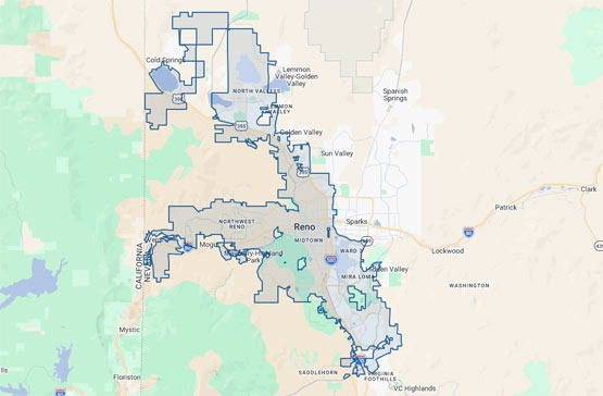
Reno, Nevada is a typical automobile-centric city in the western United States. With a population of about 260,000, its public transportation infrastructure is limited compared to larger cities, but in recent years, there has been diversification of transportation options through the expansion of bus routes, the improvement of bike lanes, and the introduction of shared mobility services.
The road structure in Reno is centered around the interstate highway system. The I-80, which runs east-west, is a key arterial road that traverses Reno, connecting San Francisco to the west and Salt Lake City to the east.
Running north-south, US-395 (also known as "the 395") cuts vertically through Reno-Sparks, linking northern California and southern Nevada.
Major arterial roads in the city include Virginia Street, E. 4th Street towards Sparks, and Double R Blvd in southern Reno. Outside the city, commercial arterial roads like Neil Road and Lincoln Way also play important roles.
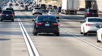
Traffic congestion is not severe in Reno, but caution is needed during rush hours and in certain areas.
Reno's rush hour occurs on weekdays from 7-9 AM and 4-6:30 PM, with the most congestion at the I-80 and US-395 interchange and the Sparks-Reno boundary area during these times. Particularly, during shift changes at the Tesla Gigafactory located in Sparks (6-7 AM, 2-3 PM, 10-11 PM), roads around the factory can become temporarily congested. In winter, the Sierra Nevada direction (Truckee/Lake Tahoe area) of Interstate 80 is frequently closed due to snowfall, affecting access roads to the city. Real-time road conditions and closure information can be checked through the NDOT (Nevada Department of Transportation) 511 system.
Public transportation is primarily based on the bus system operated by RTC Washoe (Regional Transportation Commission of Washoe County).
RTC Washoe operates about 30 bus routes in the Reno-Sparks area, using the 4th Street Station in downtown Reno and Canopy as major transfer hubs. The standard adult bus fare is $2, with a daily pass costing $4 and a monthly pass priced at $65. However, the bus frequency is long, ranging from 30 minutes to 1 hour, and service is significantly reduced during late night and early morning hours, making it inconvenient for regular public transport use. RTC has been working on route optimization and improving service frequency in recent years, and is also introducing electric buses.
Bicycle infrastructure is a rapidly developing area in Reno.
The Riverwalk bike path, created along the Truckee River, crosses the city east to west, providing over 10 miles of dedicated routes. Since the 2020s, the city has been enhancing bike lanes and bike share programs. Shared electric scooter and bike services like Lime are also operating in downtown Reno. However, the suburban areas of Reno are often too far for biking, and many sections lack dedicated bike paths, making bike commuting primarily applicable to residents near the city center.
Parking and rideshare services are also important elements of transportation in Reno.
Parking in downtown Reno is often free at large casinos and commercial facilities, so unlike Las Vegas, there is not a significant burden of parking costs. Street parking can be either free or paid depending on the area, with meter parking rates around $1-2 per hour. Uber and Lyft are also operating normally in Reno, but wait times can increase during late-night hours or when demand is high for airport pickups.
Using rideshare from Reno-Tahoe International Airport (RNO) to downtown costs about $10-15, with travel times ranging from 15 to 25 minutes depending on traffic conditions.
 NoManners212
 Pointy


 My Town My Way Blog |
 Arizona AZ Cowboy |
 Valley Hong |
 Mr Oh |
 ollege Mom |
 zoryan |
 elion |
 Nevada Teppanyaki |

 Two LaLa World |
  daddyyo |
  neapolis |
  seadoll |
  ansdal |
  Vivid U.S. Regional Information |
  Vasila's Newlywed Blog |
  Arizona Cowboy |
  merry merry |
  Hoorah Ooorah |
  Fragile Me |
  Rowland Mama |
  foxtree |
  bayaa |
  loveyom |
  Coastal city |
  Spaghetti Flying Religion |
  holy cow |
  endone |
  starline |