

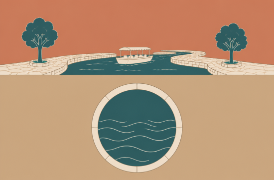
When people think of the River Walk, they often picture riverside restaurants and boat tours. I initially thought it was just a beautifully decorated tourist spot.
However, digging into its history reveals a complete turnaround. The origin of this walkway was not romance, but rather a flood.
In September 1921, the San Antonio River flooded, submerging downtown. Records show that 51 people died and 23 went missing in the surrounding areas.
In fact, warnings had come before that. In 1920, an engineering company called Metcalf and Eddy conducted a study on the floodgates and concluded that a major flood would inevitably occur again.
And sure enough, the following year, that prediction came true. Reading about it gave me chills.
Afterward, the city began serious flood management efforts. They built the Olmos Dam upstream, which was completed in 1927.
They also dug a bypass channel to drain water from the sharply bending section of the river in downtown. According to the American Society of Civil Engineers (ASCE), this was completed in 1929.
Here, a problem arose. When water was diverted into the bypass, the original winding riverbed appeared to be useless land.
So, there were discussions about completely covering that section. In hindsight, that would have been a shocking choice. If that had happened, the River Walk as we know it today would not exist.
Enter young architect Robert Hugman. In 1929, in his late twenties, he proposed not to cover the river but to create shops and walkways along the riverbank.
The local preservation group, the San Antonio Conservation Society, and some city council members supported this idea. However, the Great Depression hit the same year, and the plan was shelved for a while.
Things started moving again in the late 1930s. With funding from the federal New Deal agency, the WPA (Works Progress Administration), construction began in 1939.
According to ASCE, the WPA grant was $355,000, and over 1,000 workers were involved. Walkways, stairs, and bridges were built one by one during this time.
However, Hugman was fired from the project in 1940. There were criticisms that the newly cut limestone looked too white and stark, along with design and political conflicts.
Construction continued after that, and the first phase was completed in 1941. It's bittersweet that the person who came up with the idea didn't get to see it finished.
Even then, it didn't become an instant success. The first restaurant known along the river, Casa Rio, opened in 1946.
That same year, another major flood threatened downtown. However, thanks to the Olmos Dam and the bypass channel, the damage was significantly reduced. This was the first moment the flood management efforts proved their worth.
The real turning point came with the 1968 World's Fair, HemisFair '68. The waterway was extended toward the fairgrounds, and riverside hotels began to emerge around this time.
Hugman was officially recognized as the father of the River Walk in 1978. It was a long overdue acknowledgment, nearly 40 years after he was fired.
Interestingly, flood management has continued to be upgraded since then. Beneath the feet of today's tourists lies a nearly 3-mile-long underground tunnel.
According to the San Antonio River Authority, this tunnel has a diameter of about 24 feet and was dedicated in 1997. When heavy rains occur, it channels downtown river water underground to flow downstream.
In fact, during the major flood the following year in 1998, this tunnel was credited with protecting downtown. The timing was truly dramatic. Decades of flood management finally paid off all at once.
In 2009, the Museum Reach opened to the north, and later the Mission Reach to the south, significantly extending the walkway. This expansion also aimed at flood management and ecological restoration.
ASCE reports that the River Walk brings in over $2 billion annually to the local economy. Considering the tragedy of 1921, it's a truly dramatic turnaround.
What struck me most about this story is the perspective on public infrastructure. The channel that prevents flooding could have simply been covered with concrete, but instead, it was transformed into a space for people to walk and linger.
It's also significant that this was made possible by federal public works during the Great Depression. It created jobs while leaving a lasting asset for the city's future.
Of course, it's not all a beautiful story. The person who came up with the idea was pushed aside, and it took decades for him to be recognized.
The next time you take a boat ride on the River Walk, I hope you'll think about what's beneath your feet. Knowing that this beautiful waterway is actually a safety device protecting the city will change how you see the scenery.
 ArkEk
 HappyChicken





 Shinbaram Dr. Blog |

 Good World Good Thoughts |

 celtics |
 candytip |

 Gold Bar |

 Helpful Life Stories |

 Texas Migration Story |

 solvix18 |

 Podongi Dad Blog |

 History Repeats Itself |
 ssome |
 skykong |
 Shining Our Own World |
 gardener 007 |
 golfmaster |
 Nanana Nanana Nanana |
 Who's watching? |
 endone |
 RockStar |
 Casa Mia |
 You Only Live Once |
 Hardworking CPA |
 Joyce 77 |
 Runner Kim |
 My Town My Way Blog |
 My Miami Stories |
 Entip |
 Tony Park |
 Jean Claude Bundang Blog |
 DJ DC BLOG |