
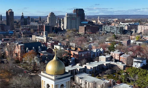
One of the most confusing things for newcomers to New Haven is understanding the neighborhood divisions.
While downtown is clear, where is East Rock, Fair Haven, and what about Westville? Today, I will systematically explain the administrative structure of New Haven and its main neighborhoods. It may seem complicated, but once you understand it, it's actually quite simple.
First, let's go over the administrative structure. New Haven is divided into 30 single-member electoral districts (Wards), and one representative from each district is elected to the Board of Alders. Each district has a population of about 4,300 people. This district division is adjusted every ten years based on census results. In terms of administrative services, there is also a unit called the Community Management Team District (CMT District). Each CMT area has a designated neighborhood manager and specialists, and community meetings are held regularly. Residents can communicate issues or local problems to the city hall through this CMT channel.
New Haven has about 40 independent neighborhoods. I will explain them by location. First, in the downtown area and its surrounding center, there is downtown itself and the historic Wooster Square. Wooster Square is known for its Italian immigrant community and is famous for Pepe's Pizza. To the north are East Rock, Newhallville, Cedar Hill, and Prospect Hill. East Rock is home to many young professionals and Yale affiliates, while Newhallville has historically been a neighborhood for the African American community. To the west are Edgewood, Westville, West River, Amity, and West Rock. Westville is a quiet residential area where many artists and middle-class families live.
There are also distinctions to the south and east. The Hill district is a residential area located southwest of downtown, while Long Wharf is a commercial and logistics district near the harbor. City Point (or Oyster Point) is a historic waterfront area. Crossing the Quinnipiac River to the east, you will find Fair Haven. Located between the Mill River and the Quinnipiac River, Fair Haven is a vibrant neighborhood centered around the Latino immigrant community.
Further east are Quinnipiac Meadows, Fair Haven Heights, and the Annex and East Shore (or Morris Cove) on the eastern side of the harbor. Each neighborhood in New Haven has its own historical background and community character, so where you choose to settle can significantly impact your lifestyle. If you are considering moving, it's important to first understand the atmosphere of each neighborhood.
 EndureBurger
 LuckyForest82
 RunHani








 UNI Lover |
 NE Hodori Preik |
 parlon |
 Ohio Ohayoung Hello |
 Coding Elf |
  My Heart Popper |
 Dream Mong |
 Lee Sang Don |
 Jenny's Mom blog |
 Buckwheat Muktudari Notebook |
  Idaho's Sumi's House |
  Mr. Midwest America |
  wildfire |
  kerkee |
  legalway |
  postcard |
  cheesecake07 |
  My Miami Stories |
  windylotus |
  Mia Flori |
  velaro29 |
  velaro |
  foxtrot83 |
  moname |
  mapleline |
  US Legal Consultation on Trials |
  Karina's Blog |
  California Dreamer |
  Choco Mint Creator |