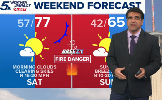
This weekend, the National Weather Service has issued a Red Flag warning as conditions for fire risk significantly increase in the San Antonio area.
The cause of this change is a cold, dry front moving in from the northeast. It's referred to as a Front in English.
This front is called a 'backdoor cold front' and is expected to start affecting the area from Saturday, bringing strong winds.
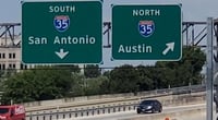
The National Weather Service announced that from 10 AM to 9 PM on Saturday, 'critical fire weather conditions' will form over a wide area including San Antonio, the Hill Country, and Austin.
According to the forecast, sustained winds will be 10 to 20 miles per hour, with gusts up to 30 miles per hour. With low humidity, even a small spark can quickly spread. There is also a possibility of similar fire risk levels continuing in areas near I-35 on Sunday afternoon.
This weekend may feel like spring with temperatures expected to reach the mid-70s in most areas, and some areas could see highs in the low 80s.
However, after the front passes, temperatures will drop significantly. Starting Sunday night, it will begin to get chilly, with Monday morning temperatures expected to fall to the upper 30s to low 40s, and there may be a chance of light frost in some areas of the Hill Country.
This is yet another temperature swing that feels like a return to winter within just a few days. The sudden dryness means that throwing cigarette butts on the road or dry grass can be a major cause of fires, so they must be completely extinguished before disposal.
It's advisable to water the grass around your home in advance and to tend to the lawn during the early morning hours when the winds are not strong.
February in San Antonio is typically a month of significant changes. During the day, you might wear short sleeves, but when going out, you'll find yourself looking for a jacket, as this weather pattern is expected to repeat.


 AH LALA |
 Information on All Regions of the United States |
 Cali M Law Group |
 What can make money? |
 vrixen73 |
 TEXAS Fishing Boat |
 solvix18 |
 University of Texas |
 Korea Forever |
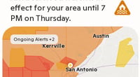
 International Court |
  Samsung My My |
  heeve |
  Forest Gump |
  Life in the US |
  silver |
  glenix39 |
  Young Kim and Cheol's Blog |
  RV Samuel's Dad |
  Seattle - Emerald City |
  Alaska Kim |
  vegas mom |
  Eating Gukbap and Working Hard Deer |
  My Town My Way Blog |
  Alabama Bang |