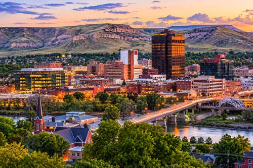
Billings is the county seat of Yellowstone County in Montana.
In the U.S. administrative system, a county is a unit of administration below the state level, and Yellowstone County oversees Billings and its surrounding areas. The total area of Yellowstone County is approximately 2,633 square miles (about 6,819 km²), and the total population of the county is around 162,000 as of 2020. The city of Billings itself covers about 44 square miles (approximately 114 km²).
The city of Billings can be divided administratively into several areas, including Downtown Billings, South Side, West End, North Side, and East Billings. Downtown is the historical and commercial center of Billings, featuring the city hall, courthouse, major office buildings, restaurants, and retail shops. The primary ZIP code for this area is 59101. To the north of Downtown, the impressive Rimrocks sandstone cliffs create an iconic natural landscape for the city.
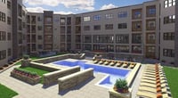
The West End is the fastest-growing residential and commercial area in Billings, centered around the west side of King's Avenue, with many large shopping centers, hospitals, schools, and new residential developments. Rimrock Mall and large retail stores are located in this area, along with major healthcare facilities like St. Vincent Healthcare and Billings Clinic. The primary ZIP codes for this area are 59102 and 59106.
The South Side is an older residential area located south of Downtown, characterized by historic homes and local small businesses. This area has a diverse population, with a relatively high percentage of Hispanic and Native American residents. The South Billings Boulevard area features auto dealerships, warehouse-style businesses, and small industrial facilities. The North Side is a residential area above the Rimrocks, offering a relatively quiet and nature-friendly environment.
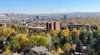
East Billings is a residential and light industrial area that extends eastward, including the Midland area. This area is home to Billings Logan International Airport, with many hotels, rental car companies, and logistics-related facilities surrounding the airport. Billings Heights, located north of the Yellowstone River and above the Rimrocks, is another growing area where new housing developments and schools are continuously being built. The ZIP code 59105 primarily covers this area.
To summarize the main ZIP codes in Billings, 59101 covers Downtown and the central area, 59102 is for the West End, 59105 is for Billings Heights and the northeastern area, and 59106 is for the outskirts of the West End. Some areas between 59101 and 59102 are managed under 59101. When writing an address, it is essential to include MT (the abbreviation for Montana) and the corresponding ZIP code after the city name. It is important to verify the correct ZIP code when moving, receiving mail, or completing various documents.
In terms of school districts, most of the city of Billings falls under Billings Public Schools (officially named School District 2). However, some areas of Billings Heights may belong to separate school districts (such as Lockwood School District), so it is advisable to check the school district for the specific address before enrolling children. The Montana Department of Education and the Billings Public Schools website provide address-based school district searches.
 Coffeemania
 MintJourney
 CupRamenArmy


 blues town |
 ultron78 |
 heartwarming |
 CA Real Estate |
 lumix88 |
 tarvion |


 Yo Lock Me Up |
  The Long Shot |
  total solution |
  Vacation on Hawaii |
  TungTung's Dad Blog |
  Kitchen Ideas |
  Sandiego Auntie |
  Baguette Blog |
  Illinois alpaca |
  International Court |
  Samsung My My |
  heeve |
  Forest Gump |
  Life in the US |
  TEXAS Fishing Boat |
  silver |
  glenix39 |
  Young Kim and Cheol's Blog |