

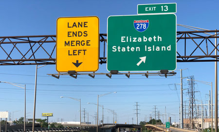
Staten Island is part of New York City, but due to its geographical nature as an island, its transportation system is quite different from the other boroughs.
Understanding the transportation infrastructure and characteristics of this area is important information for both residents and visitors of Staten Island. In this article, we detail all the major transportation options available on Staten Island.
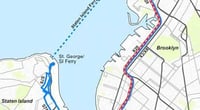
The most iconic feature of Staten Island transportation is the Staten Island Ferry. This ferry connects the Whitehall Terminal at the southern tip of Manhattan to the St. George Terminal on Staten Island in about 25 minutes. It is a free public transportation service operated by New York City, serving over 20 million passengers annually. It operates 24 hours a day, 7 days a week, with service every 15 to 20 minutes during peak commuting hours. It is also a tourist attraction, offering stunning views of the Statue of Liberty and the Manhattan skyline, making it popular among travelers. The ferry allows bicycles, making it useful for bike commuters as well.
The Staten Island Railway (SIR) is a light rail system that operates within the island. It runs along the eastern side of the island from St. George to Tottenville, with 22 stations along the route, covering a total distance of about 14 miles (22.5 km). It can be accessed using a MetroCard, following the New York subway fare system. When connected with the ferry, it allows for seamless travel from Manhattan to the southern part of Staten Island without transfers. However, since the railway only covers the eastern part of the island, residents in the western or central areas may find it less beneficial.
The bus system is the main public transportation option that covers Staten Island. The Staten Island bus routes operated by the New York MTA (Metropolitan Transportation Authority) include express bus routes that connect the island to Manhattan. The Staten Island-Manhattan Express Bus (SIM series) directly connects downtown Manhattan and Midtown, allowing commuters to travel to Manhattan without using the ferry. However, buses are susceptible to traffic congestion, often taking much longer than expected during peak commuting hours.
Cars are practically an essential mode of transportation for Staten Island residents.
The public transportation options on the island are limited compared to Manhattan, and residential areas are widely dispersed, making it inconvenient to travel without a car. The car ownership rate on Staten Island is significantly higher than the New York City average, which is related to the relatively abundant parking infrastructure in this suburban environment.
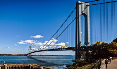
Bridges and tunnels are key infrastructures that connect Staten Island to the mainland. The Verrazzano-Narrows Bridge connects Staten Island and Brooklyn and held the record for the longest suspension bridge in the world when it opened in 1964. It is still famous as the starting point for the New York Marathon. There is a toll fee that varies depending on the direction. Staten Island is also connected to New Jersey by three bridges: the Goethals Bridge, the Bayonne Bridge, and the Outerbridge Crossing. The accessibility to New Jersey through these bridges is good, and many Staten Island residents commute to New Jersey or visit shopping malls there.
Traffic congestion is one of the main complaints among Staten Island residents. The most congested areas are the entrances to the Verrazzano Bridge and major roads within the island, experiencing severe delays during peak commuting hours (7-9 AM, 5-7 PM). In particular, the main roads that run north to south across the island (Hylan Boulevard, Richmond Avenue, Victory Boulevard, etc.) often face significant delays during these times. The congestion pricing policy introduced by New York City in 2019 charges fees for vehicles entering the central part of Manhattan, and Staten Island residents, who already pay the Verrazzano Bridge toll, have expressed dissatisfaction with the double tolls.
Bicycles and electric scooters are still less developed modes of transportation on Staten Island compared to other boroughs. The hilly terrain and lack of bicycle infrastructure (such as bike lanes) pose barriers. However, some flat areas do see bike commuters, and Staten Island is included in New York City's plans for bicycle infrastructure investment, so improvements are expected in the future.
Ride-sharing services like Uber and Lyft are also actively used on Staten Island. Many residents rely on taxis or ride-sharing services during inconvenient times or in areas where public transportation is lacking. When traveling to Manhattan, using Uber can significantly increase costs due to the Verrazzano Bridge toll and driver fees.
While Staten Island's transportation infrastructure has its inconveniences due to its island status compared to other New York boroughs, utilizing the ferry and express buses can significantly enhance accessibility to Manhattan. If you are planning to move, it is advisable to understand the commuting routes between your residence and workplace in advance and to simulate the commuting times and methods specifically. If you are accustomed to a car-centric lifestyle, Staten Island is relatively easy to maintain that pattern within New York City.
 explorer77
 Gemini92



 yentra |
 Cali M Law Group |
 quanta7 |
 Helpful Life Stories |
 wendra |
 crystalo |
 lavender |
 dermoon |
  draxen |
  gallery |
  milkyotter |
  Zoom Zoom Zoom |
  Minnesota Lakes and Clouds |
  noraro |
  tervox95 |
  vale vale |
  Golden life |
  andrew park |
  Peter Pan Pet |
  Balan |
  neroyo |
  Dreams Come True as Desired |
  Khan Film Blog Production |
  coloradoman |
  Living Economy Information Blog |
  rustley |