
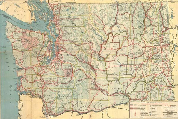
I happened to find a map of Washington State from the 1950s tucked away on a shelf in the storage room. It was a map from a time when the names of cities we know today, like Seattle, Bellevue, Redmond, and Tacoma, still seemed unfamiliar.
The freeways were not as interconnected as they are now; they were sporadically interrupted, and what is now known as the Silicon Forest, the IT belt, was just forest and farmland. As I looked at the map, I naturally wondered how this quiet northwestern state created the economic structure we see today right after World War II.
Since the end of the war in 1945, Washington experienced one of the fastest industrial transitions in the United States. During the war, the Seattle and Tacoma area was a key hub for the production of warships, bombers, and military supplies. Hundreds of thousands of workers flocked to the area, and shipyards and aircraft factories operated around the clock. When the war ended, many expected the region to fall into stagnation again. However, the reality was the opposite. The technology, workforce, and infrastructure accumulated through the military industry were seamlessly transferred to the civilian sector, leading to even greater growth.
A prime example is Boeing. Boeing secured a massive factory and skilled labor force through bomber production during the war. After the war, they transitioned these assets to civilian aviation, and from the mid-1950s, they ushered in the era of jet airliners, positioning themselves at the center of the global aviation industry. Engineers, technicians, and suppliers flocked to the Seattle area, and the entire city began to reorganize around the aviation industry. This is the backdrop of how the small port city of Seattle transformed into a global corporate city in just a few decades.
Alongside the aviation industry, another growth driver for Washington was hydroelectric power. Large dams were continuously built along the Columbia and Snake Rivers, providing immense amounts of electricity. Cheap power attracted energy-intensive industries like aluminum smelting, wood processing, and chemical manufacturing. In particular, the aluminum industry grew rapidly in conjunction with aircraft manufacturing, creating a virtuous cycle that enhanced the competitiveness of the aviation sector.
Agriculture also underwent significant changes. With the expansion of irrigation facilities, the dry lands of eastern Washington transformed into large-scale agricultural areas. Crops like wheat, apples, and cherries flooded the national market, and the food processing industry grew. The balance between agriculture and industry led to a stable expansion of the economic foundation across the state.
One particularly striking aspect of the 1950s map is the roads and ports. Ports were densely arranged along the Puget Sound coastline, and the rail and road networks leading inland were just beginning to take shape. This transportation infrastructure strengthened the role of the region as a gateway for Pacific trade, and the expansion of trade with Asia became a crucial pillar supporting Washington's economy for decades to come. At that time, it was still before the container revolution, but the foundation as a trade center was already being established.
Underlying all these changes was the technology workforce and educational infrastructure left by the war. Research institutes and universities expanded for military research continued to produce scientific and technological talent even after the war, laying the groundwork for companies like Microsoft and Amazon to emerge in the future. The companies that would not yet exist in the 1950s were already having their seeds sown during this period.
Washington in the 1950s still had a quiet and rough appearance, but within it lay an incredible energy that transformed the scars of war into the driving force for economic growth. Aircraft factories, hydroelectric plants, agricultural areas, ports, and railroads began to operate as one massive growth engine, resulting in the northwestern economic hub we know today.
A single old map seems to have provided a different perspective on the current Seattle skyline.


 RV Samuel's Dad |
 My Town My Way Blog |
 Tiger Milk Foam Research Institute |
 Breaking Bad Drama |
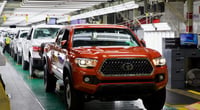
 University of Texas |
 Texas Migration Story |
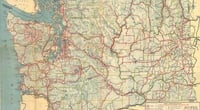
 Medical Latest Trends News |
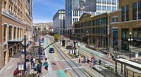

 General Knowledge Blog |
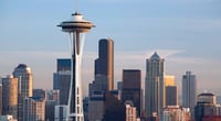
 Information on All Regions of the United States |
  Kitchen Ideas |
  Sandiego Auntie |
  Baguette Blog |
  Illinois alpaca |
  International Court |
  Samsung My My |
  heeve |
  Forest Gump |
  Life in the US |
  TEXAS Fishing Boat |
  silver |
  glenix39 |
  Young Kim and Cheol's Blog |
  Seattle - Emerald City |
  AH LALA |
  Alaska Kim |
  vegas mom |
  Eating Gukbap and Working Hard Deer |