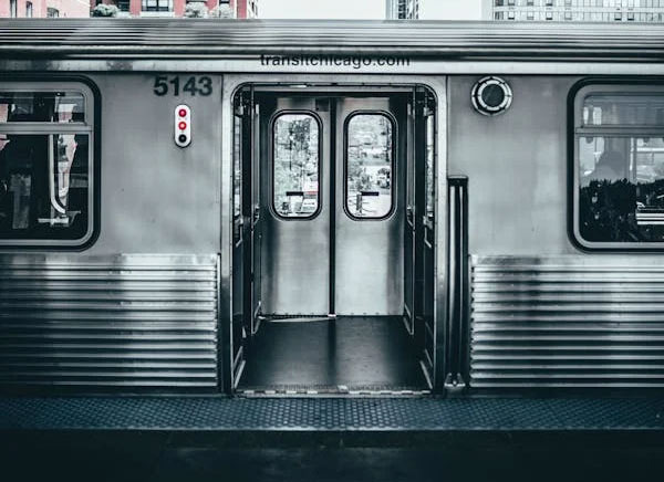
The Chicago Transit Authority operates the subway system in Chicago, connecting the city and suburban areas, providing a convenient means of transportation for residents and visitors.
It features a circular structure known as the Loop, which connects the downtown area to the suburbs, linking Chicago with 35 nearby satellite cities.
There is a perspective that the name "L" comes from the first letter of "Loop", but it is not widely accepted.
Overview of the CTA "L" System- Opened: 1892, one of the oldest subway systems in the U.S.
- Number of Lines: A total of 8 main lines
- Number of Stations: About 145
- Operating Hours: Most lines operate 24 hours, making it one of the few systems in the U.S. that runs 24 hours alongside the New York subway.
- Operating Distance: Approximately 224 miles (360 km)
Main Lines and Colors
The subway lines of the CTA are distinguished by colors.
Red Line
- Features: One of the busiest lines in Chicago, running from Howard in the north to 95th Street in the south.
- Key Stops: Downtown Chicago, Loyola University, Chinatown
Blue Line
- Features: An airport connection line, linking O'Hare International Airport with downtown Chicago.
- Key Stops: O'Hare Airport, Downtown Loop, Forest Park
Brown Line
- Features: Connects the northwest area with the Loop, passing through popular residential neighborhoods in Chicago.
- Key Stops: Lincoln Park, Lakeview
Green Line
- Features: Connects the south and west areas, particularly passing through the South Side.
- Key Stops: Washington Park, near the University of Chicago
Orange Line
- Features: Connects Midway International Airport with downtown.
- Key Stops: Midway Airport, Loop
Purple Line
- Features: Primarily connects northern Chicago with Evanston, mainly used by commuters.
- Key Stops: Northwestern University, Loop (during rush hours only)
Pink Line
- Features: Connects the western suburbs with the Loop.
- Key Stops: Pilsen, Loop
Yellow Line
- Features: A short line connecting Skokie in northern Chicago.
Main Features and Advantages
Loop:
- A system of elevated tracks surrounding the heart of downtown Chicago, with most lines passing through here.
- Major stations within the Loop provide convenient access to the city's commercial, tourist, and business centers.
Connectivity:
- Connects Chicago's major airports (O'Hare, Midway) with various parts of the city.
- Linked with Metra commuter trains and major bus routes, making access to suburban areas easy.
Convenience:
- Provides real-time arrival information through digital screens and apps.
- Allows easy payment on buses and subways using the Ventra Card.
Modernization and Improvement Efforts
- Station Renovations: Efforts are being made to modernize historic stations while preserving their cultural value.
- Safety and Efficiency: Improving user experience through the installation of surveillance cameras and the introduction of faster trains.
- Environmentally Friendly: Implementing energy-efficient train operations and sustainable design considerations.
Tips for Tourists
- 1-Day/Weekly Pass: Tourists can save time and money by using the unlimited Ventra card pass.
- CTA App: Provides real-time location and route information to assist with travel and sightseeing.
- Access to Major Attractions: Using the "L" system makes it easy to visit major tourist spots like Navy Pier, Millennium Park, and museums.
The Chicago "L" symbolizes the culture and history of the city, offering convenience and a unique experience beyond just public transportation.


 Illinois Park Sung-Soo Blog |
 Rice Shop Uncle BLOG |
 blues town |
 Electricity Field Certification Collector |
 Chicagonian |
  ultron78 |
  Kitchen Ideas |
  Sandiego Auntie |
  Baguette Blog |
  Illinois alpaca |
  International Court |
  Samsung My My |
  heeve |
  Forest Gump |
  Life in the US |
  TEXAS Fishing Boat |
  silver |
  glenix39 |
  Young Kim and Cheol's Blog |
  RV Samuel's Dad |
  Seattle - Emerald City |
  AH LALA |
  Alaska Kim |
  vegas mom |