
Rancho Cucamonga, located an hour east of LA, is often cited as a great place to live in California, but those who have lived in the area for a long time have always respected nature.
Long before housing developments were built, the Tongva and Serrano Native American tribes lived in this area. They moved along seasonal rivers and foothills coming down from the San Gabriel Mountains and understood that wildfires are a part of nature. There are records of them experiencing the natural cycle where new grass grows and game increases after a large wildfire passes through.
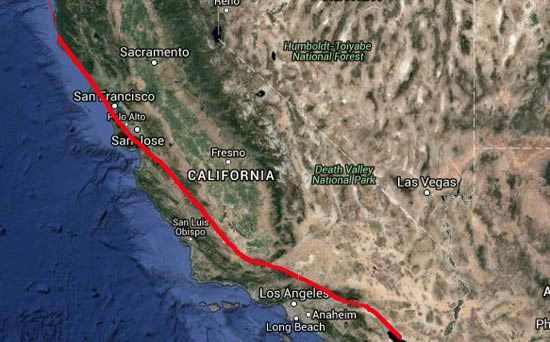
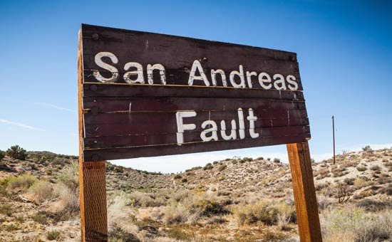
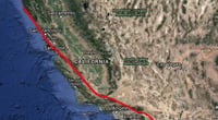
The natural disaster that residents of Rancho Cucamonga are most concerned about is undoubtedly earthquakes. Just north of the city runs the world-famous San Andreas Fault.
In 1857, a magnitude 7.9 earthquake known as the Fort Tejon Earthquake occurred along this fault.
At that time, Southern California was not as developed as it is now, so the loss of life was limited, but it is recorded that the fault split over 300 km and the ground moved several meters in an instant.
Geologists have consistently warned that a similar magnitude earthquake could occur again someday.
That is why in California, children learn the safety procedure "Drop, Cover and Hold On" from a young age.
When an earthquake starts, the safest method is to not run outside but to first get down, take cover under a sturdy desk, and hold on until the shaking stops.
It is recommended to have at least 72 hours' worth of drinking water, emergency food, flashlights, backup batteries, and first aid supplies prepared at home.
The second natural disaster to be cautious of is wildfires. The San Gabriel Mountains north of Rancho Cucamonga become very dry in the summer and fall.
When the Santa Ana winds start blowing, a small spark can quickly turn into a large wildfire.
In fact, the 2003 'Old Fire' swept through the San Bernardino Mountains, threatening thousands of buildings and prompting evacuation orders for nearby residents. In 2013, the 'Etiwanda Fire' occurred in the northern foothills of Rancho Cucamonga, burning over 2,000 acres and facing challenges in containment due to strong winds. The 2022 'Route Fire' and 2024 'Line Fire' also served as reminders of the wildfire risks for Southern California residents.
Particularly, areas north of Alta Loma or near the Etiwanda foothills are classified as fire hazard zones, making it difficult to obtain homeowners insurance or resulting in high premiums.
Another phenomenon that residents are accustomed to is the Santa Ana winds. Between fall and early winter, cold, dry air from the desert moves over the mountains, creating strong winds that can exceed 80 miles per hour at times.
When these winds blow, branches can break, power outages can occur, and most importantly, they are a major cause of wildfires spreading rapidly.
Flooding is relatively less common compared to other areas, but during winter atmospheric river events, heavy rains can cause mud and water to overflow onto low-lying roads and drainage systems.
Just as the Native Americans observed the changes in the mountains and valleys, today's residents of Rancho Cucamonga should also engage in earthquake preparedness training, check wildfire alerts, and prepare emergency supplies.
 ChouDoor
 UrbanZakapi


 Cali M Law Group |
 American Leisure Activities Blog |
 vintage |
 Young Kim and Cheol's Blog |
 Only Dentalbay |
 Experiences Living in America |
 Solo Yolo |
 Golden Knights |
  Donghoon Kim USA Life Blog |
  What can make money? |
  Let's Be Like a Salt-like City Person |
  honeycom |
  santo melon |
  The Emperor Must Grow |
  vintago |
  International Court |
  California Dreamer |
  Magic Cabbage School of Martial Arts |
  Today’s Jajang Chef |
  vegas mom |
  Coding Elf |
  Con Cheese |
  Things to Do to Buy a House |
  US Embassy |
  productionblog |
  Anjollinya Blog |