
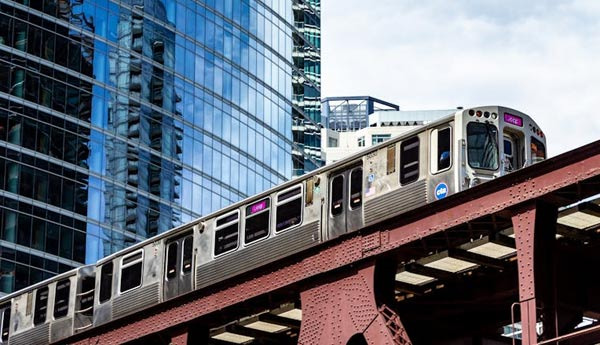
Chicago's light rail system, known as 'L', is short for 'elevated', referring to its elevated rail structure.
At the center of this system is the elevated Loop line, which serves as a key transportation hub in downtown Chicago.
Structure and Role of the Loop
-
Shape: The Loop is a 1.79-mile (approximately 2.88 km) elevated train line that surrounds downtown Chicago in a square shape.
-
Route: It is formed along Lake Street to the north, Wabash Avenue to the east, Van Buren Street to the south, and Wells Street to the west.
-
History: The Loop was constructed in stages between 1895 and 1897, officially opening on October 3, 1897.
-
Operation: Currently, the Loop has 8 stations and functions as the central hub of the 'L' system operated by the Chicago Transit Authority (CTA).
Lines Using the Loop
The Loop is a point where several lines of the Chicago 'L' system intersect, including the following lines that pass through or terminate at the Loop:
-
Brown Line: Circles the Loop counterclockwise.
-
Orange Line: Circles the Loop clockwise.
-
Pink Line: Circles the Loop clockwise.
-
Purple Line: Circles the Loop clockwise during weekday rush hours.
-
Green Line: Passes through the Loop, connecting the north and south.
Additionally, the Red Line and Blue Line pass underground beneath the Loop, allowing transfers to stations inside and outside the Loop.
Historical Significance of the Loop
The Loop is not just a means of transportation but a symbolic structure deeply rooted in Chicago's history and culture. In the mid-20th century, it faced the threat of demolition, but it was preserved due to its recognized historical value and identity of the city. Today, the Loop is one of Chicago's iconic landscapes, beloved by many tourists and residents.


 zanero |
 Soy Angelino |
 eatontown blog |
 Learn English Accurately |
 Let's Be Like a Salt-like City Person |
 Illinois Park Sung-Soo Blog |
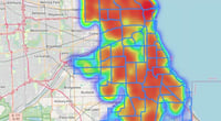
 Rice Shop Uncle BLOG |
 blues town |
 Electricity Field Certification Collector |
 Samsung My My |
  heeve |
  Forest Gump |
  Life in the US |
  TEXAS Fishing Boat |
  silver |
  glenix39 |
  Young Kim and Cheol's Blog |
  RV Samuel's Dad |
  Seattle - Emerald City |
  AH LALA |
  Alaska Kim |
  vegas mom |
  Eating Gukbap and Working Hard Deer |
  My Town My Way Blog |
  Alabama Bang |
  Information on All Regions of the United States |
  USA East News, Information |