
Rockville, MD is uniquely positioned in Maryland. When thinking of Maryland, one might first think of Baltimore or the Chesapeake Bay to the east, but Rockville is located in the opposite direction, to the southwest, just above Washington D.C.
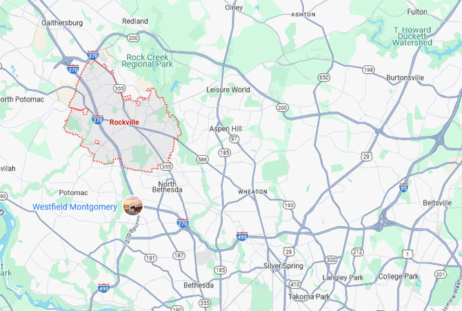
When you unfold the map, the shape of Maryland resembles a crab with one claw extended, and Rockville is situated at the 'claw' part, which is the southwestern tip facing the metropolitan area. Administratively, it is the central city of Montgomery County, just a 20-25 minute drive from Washington D.C. Geographically, Rockville can be considered one of the pillars of the Greater Washington Metropolitan Area and one of the economic centers of Maryland.
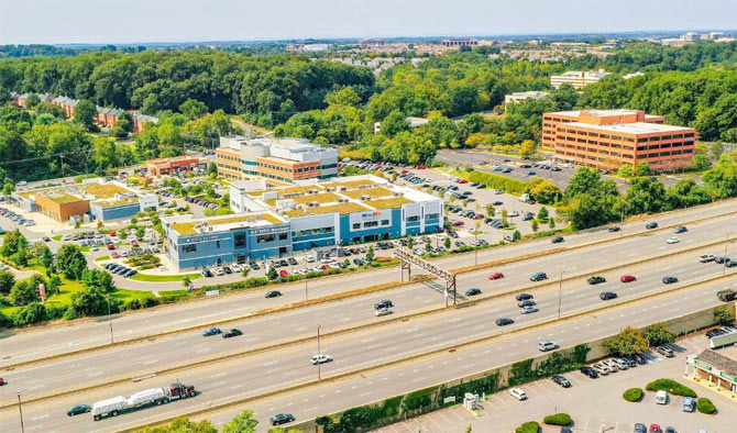
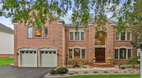
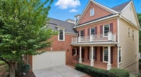
Rockville, MD maintains a completely 'suburban character' while being right next to a major city. If Washington D.C. is a city of politics and diplomacy, Rockville is a city of education, science, and business. The entire city is planned, with modern office buildings, shops, and restaurants clustered in the downtown area, while just a short distance away, you find quiet residential neighborhoods and tree-lined streets. This structure allows residents to enjoy both 'urban accessibility and residential stability.'
Montgomery County, where Rockville is located, is one of the wealthiest areas in the United States. Many federal government employees, researchers, and IT professionals reside here, making it a convenient distance for daily commuting to Washington D.C. The Metro (Washington subway) Red Line passes through Rockville, allowing for easy access to the city center without a car. Geographically, Rockville is only a few miles from the northern boundary of Washington D.C. Thus, to the south of Rockville is Washington D.C., to the north is Germantown, to the east is Silver Spring, and to the west is Gaithersburg, forming a large living area.
Interestingly, despite Rockville's latitude being slightly north of Washington D.C., the actual perceived temperature and climate are quite similar. The average annual temperature is about 55°F (13°C), with hot and humid summers and slightly chilly winters. In July, the average daytime temperature rises to about 86°F (30°C), while in January, it drops to around 42°F (6°C) during the day and 27°F (-3°C) at night. Snow occasionally falls, but it does not accumulate as much as in western Maryland. Spring and fall are relatively mild, with pleasant weather perfect for outdoor activities. Thanks to this weather, Rockville has many parks and walking trails.
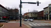
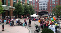
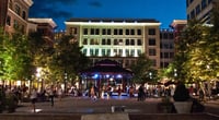
A representative place is 'Rockville Town Square,' which serves as both a shopping mall and a civic plaza. Surrounding it are Starbucks, small bookstores, and local restaurants, and on weekends, farmers' markets or street performances bring vibrancy. Being adjacent to the metropolitan area also provides excellent cultural accessibility. It takes only 30 minutes to reach the National Mall or the Smithsonian museums, allowing residents to enjoy the cultural life of a major city. However, just a little further north, a completely different landscape emerges.
Along the Potomac River, there are natural parks and farmland, making it possible to traverse the boundary between urban and rural life in a single day, which is one of Rockville's charms. Additionally, due to the unique shape of Maryland's map, Rockville has developed a unique identity as 'above Washington D.C. but essentially part of the metropolitan area.' Although it is administratively in Maryland, its living and economic zones belong to D.C., and most residents commute to downtown Washington. So, while it appears on the map as Maryland, in reality, it is a city of 'Washington people.'
In conclusion, Rockville symbolizes the geographical features of Maryland. To the east lies the plains of the Atlantic coastal region, and to the west, the gentle ridges of the Appalachian Mountains extend, with Rockville situated in between. I believe Rockville is a city that exists in the shadow of Washington D.C. while possessing its own unique charm.

 Annapolis NSA |
 citrus pop |

 American History This and That |
  Illinois Mom |
  Nuchuhan Exploration BLOG |
  Yo Lock Me Up |
  The Long Shot |
  blues town |
  total solution |
  Vacation on Hawaii |
  TungTung's Dad Blog |
  ultron78 |
  Kitchen Ideas |
  Sandiego Auntie |
  Baguette Blog |
  Illinois alpaca |
  International Court |
  Samsung My My |
  heeve |
  Forest Gump |
  Life in the US |
  TEXAS Fishing Boat |